
Rain Returns to Chicago as Temperatures Hold Steady in the 50s
Residents face an 84 percent chance of precipitation tonight, with high winds and overcast skies expected to persist through the weekend.
By Christopher Singh ·
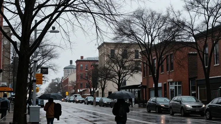
Chicagoans should brace for a wet end to the workday as rain moves in this evening. The weather service predicts an 84 percent chance of precipitation during the night hours, a sharp increase from the 25 percent likelihood reported for the first half of the day. This shift marks a distinct change from the morning conditions, which featured a mix of sun and clouds.
Temperatures remain mild for late October. The high for the day is projected to reach 59 degrees Fahrenheit, or 15 degrees Celsius. The low temperature will dip to 52 degrees Fahrenheit, or 11 degrees Celsius. The wind chill factor, or the actual felt temperature, is expected to stay consistent at 59 degrees Fahrenheit for both the high and low readings.
Wind conditions will remain manageable but persistent. Gusts are forecast to reach a maximum of 9.32 miles per hour during the day. As evening settles in, wind speeds are expected to ease slightly to 8.08 miles per hour. These conditions accompany a day that offers 10 hours of daylight. Sunrise occurred at 7:20 a.m., and sunset is scheduled for 5:48 p.m.
The wet trend continues into Saturday. Forecasters expect overcast skies with widespread light rain throughout the day. The temperature range will narrow slightly, with a high near 59 degrees Fahrenheit and a low around 54 degrees Fahrenheit. Precipitation chances remain elevated on Saturday, with a 60 percent probability in the morning, 55 percent in the afternoon, and 60 percent in the evening.
Chicago’s climate is defined by its continental humidity, a pattern that brings distinct seasonal extremes. Winter temperatures in the city typically average between 20 and 35 degrees Fahrenheit. Summers tend to be warm and humid, with daily averages ranging from 70 to 85 degrees Fahrenheit.
Spring and autumn serve as transitional periods with wide temperature swings. Daily averages during these months usually fall between 40 and 70 degrees Fahrenheit. While these figures represent long-term averages, actual daily temperatures can vary based on immediate weather patterns. Residents are advised to prepare for fluctuating conditions throughout the year.
The city is known for its unpredictable weather patterns. The current forecast aligns with the typical variability seen during the fall season. Keeping track of daily updates allows individuals to plan their routines effectively. The mix of cool temperatures and high rain probabilities requires attention for anyone traveling on foot or by car.
The forecast data comes from AccuWeather. Their models provide the specific percentages for rain and the detailed temperature breakdowns for the coming days. The information covers the immediate 24-hour period as well as the outlook for the next seven days. Local news outlets continue to publish these reports to help the public stay informed.
The contrast between today’s morning and tonight’s weather illustrates the rapid changes possible in the region. A dry start gives way to heavy rain chances as the night progresses. The steady temperatures suggest a lack of dramatic cold front movement, but the precipitation will dominate the evening experience.